Measure any parking lot without leaving your desk.
Pull up any property by address, trace the asphalt, count the stalls, and send a polished quote — all from satellite imagery. No measuring wheel. No site visit. No guesswork.
One free takeoff, no account needed. Sign up anytime to save & send proposals.
Three steps from address to estimate.
No training, no manuals. If you can use Google Maps, you can run a takeoff.
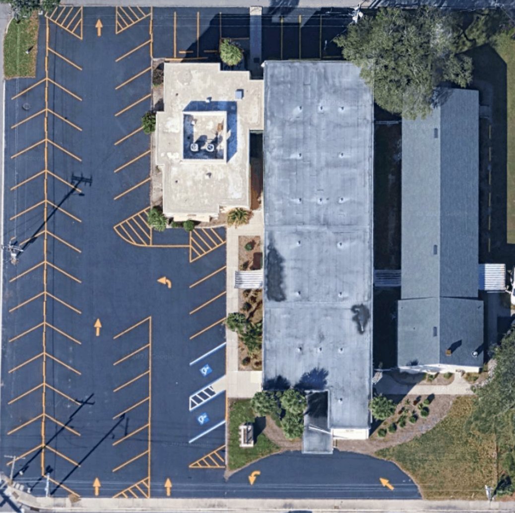
Enter the address
Type any property address and the satellite view drops you right on the lot, ready to measure.
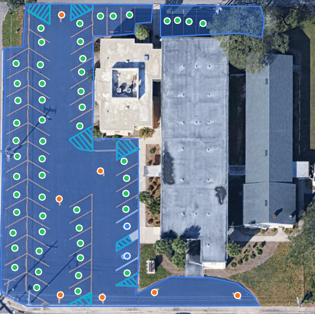
Trace & count
Drag to outline asphalt, click to drop stalls, arrows, and stop bars. Square footage and counts tally as you go.
Send the quote
Turn your measurements into a branded PDF report and a priced proposal you can text or email in seconds.
Everything a striping crew needs. Nothing it doesn't.
Purpose-built for parking lot striping, sealcoating, and line-painting contractors — not a bloated construction suite.
Accurate measurements
Asphalt square footage, linear striping footage, and exact stall counts — measured to the foot off high-resolution imagery.
You're in control
No black-box guessing. You trace exactly what gets striped, so the numbers match the job — every time.
Professional reports
One-click PDF reports with a feature-by-feature breakdown and labeled maps that make you look like the biggest shop in town.
Quotes that close
Build a priced proposal straight from the takeoff and send a clean, shareable link your customer can open on their phone.
Works on your iPad
Draw takeoffs by finger or stylus in the truck, the office, or on the job site. Saved automatically to your account.
Every job, saved
All your takeoffs live in one dashboard, sorted by date. Reopen, tweak, and re-quote any property in seconds.
The measuring wheel retires today.
Compare the old way, the expensive way, and the ParkingLotLogic way.
One flat price. Unlimited takeoffs.
No per-takeoff fees, no credit packs, no surprises. Start free and upgrade when you're ready.
Free
Kick the tires on real jobs.
- 5 takeoffs to start
- All measurement tools
- PDF reports
- Saved project history
Pro
For the working striping crew.
- Unlimited takeoffs
- Branded PDF reports
- Quote & proposal builder
- Shareable customer links
- Saved pricing templates
Managed
We do the takeoffs for you.
- Everything in Pro
- Done-for-you takeoffs
- 24-hour turnaround
- Just send us the address
Your next bid is two minutes away.
Stop driving to every property. Start measuring lots and sending quotes from wherever you are.
Start Your First Takeoff — FreeGood questions, straight answers.
How accurate are the measurements?
You trace the lot yourself off high-resolution satellite imagery, so accuracy is in your hands — typically within a few feet, which is more than precise enough for striping and sealcoating bids. Because you draw exactly what gets painted, the numbers match the work.
Does it use AI?
Today, ParkingLotLogic is a fast manual tool — you trace the lot and stay in full control of every measurement, with nothing hidden behind a black box. AI auto-detect is on our roadmap: soon you'll be able to let the tool pre-fill stalls, asphalt, and striping automatically, then review and adjust before you quote. You'll get the speed of automation without giving up control.
Is it a Go iPave replacement?
Yes. Go iPave was retired in 2025. ParkingLotLogic picks up where it left off — purpose-built for pavement contractors, with modern reports, quoting, and a far simpler price.
Do I need to install anything?
No. It runs in your browser on any computer or iPad. Your takeoffs save automatically to your account so you can pick up right where you left off.
What does "Managed" mean?
On the Managed plan you send us an address and our team completes the full takeoff for you within 24 hours — perfect for big lots or busy weeks when you'd rather not draw it yourself.